
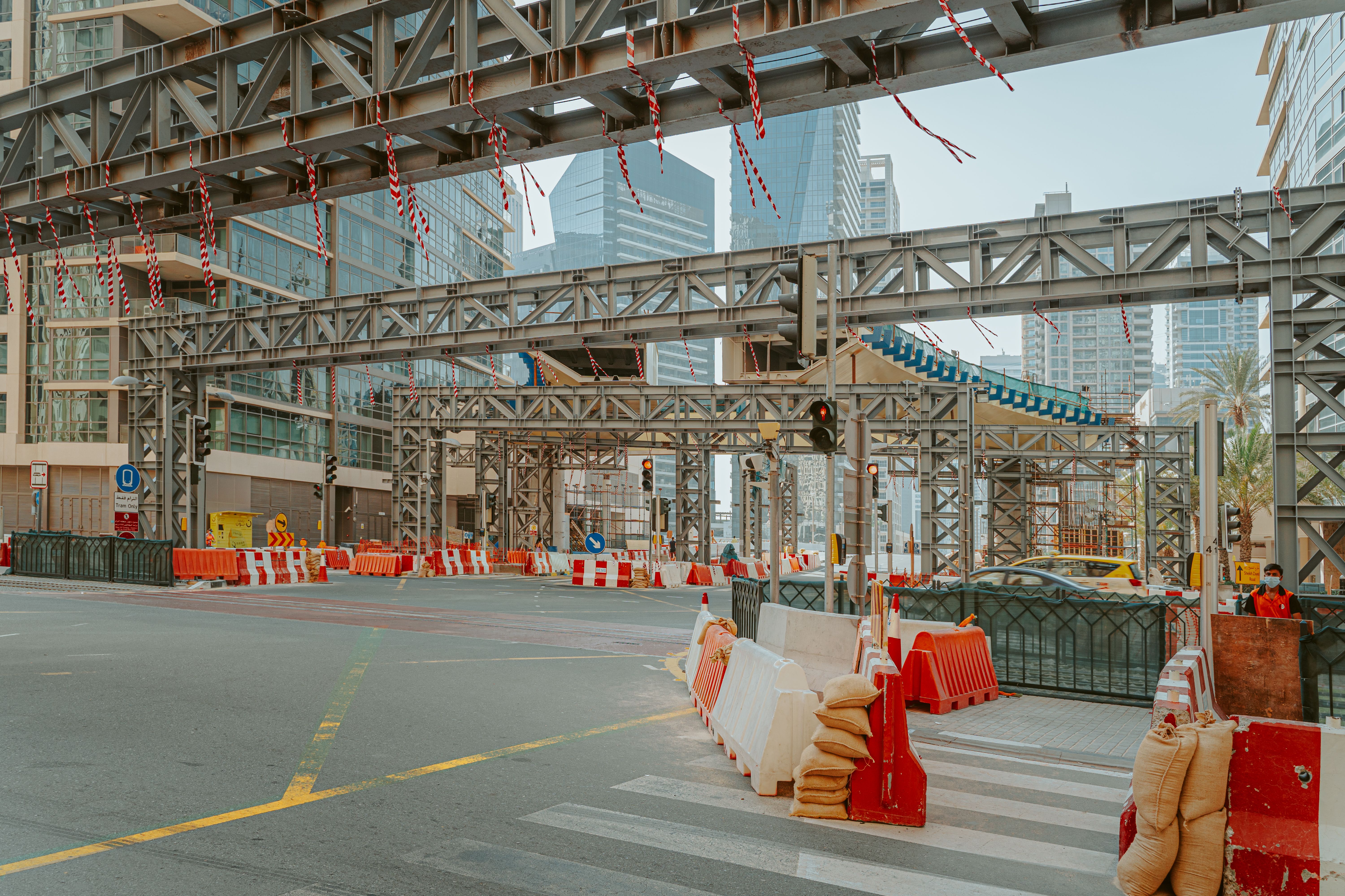
Construction projects in Dubai are becoming larger, more complex, and increasingly dependent on precise coordination between architects, engineers, contractors, and surveyors. From high-rise buildings and residential developments to roads, infrastructure, and commercial projects, even a small positioning error at the beginning of construction can create significant problems later.
This is why a construction setting out survey in Dubai is an essential part of the construction process.
Construction setting out converts the dimensions, coordinates, and positions shown in approved drawings into precise physical locations on the construction site. Surveyors establish reference points, grids, building lines, column positions, foundation locations, levels, and other critical elements so that construction teams know exactly where each component must be built.
For developers and contractors, professional setting-out services in Dubai help reduce alignment errors, rework, delays, and costly construction corrections.
What Is a Construction Setting Out Survey?
A construction setting-out survey is the process of transferring the design information from engineering and architectural drawings onto the actual construction site.
Before construction begins, surveyors establish reliable control points and reference coordinates. These references are then used to position construction elements accurately.
Depending on the project, setting out may include:
- Building grid lines
- Foundation locations
- Column positions
- Structural walls
- Road alignments
- Drainage structures
- Property boundaries
- Building corners
- Levels and elevations
- Borehole locations
- Infrastructure elements
The purpose is simple: the physical construction must match the approved design as accurately as possible.
Why Construction Setting Out Is Important in Dubai
Dubai’s construction environment includes high-rise developments, large master-planned communities, transport infrastructure, commercial buildings, and complex mixed-use projects.
As projects become more complicated, construction teams cannot rely on visual estimation or manual measurements alone.
A professional construction survey company in Dubai provides the survey control and positioning information required to execute the design accurately.
Incorrect setting out can result in:
- Misaligned columns
- Incorrect foundation positions
- Boundary encroachments
- Incorrect building orientation
- Road alignment problems
- Drainage issues
- Structural coordination conflicts
- Costly rework
- Construction delays
The earlier an error is detected, the easier and cheaper it is to correct.
Construction Setting Out Process
A professional survey normally follows a structured process.
1. Review of Project Drawings
The survey team first reviews the architectural, structural, civil, and engineering drawings.
The objective is to understand:
- Project coordinates
- Building grids
- Dimensions
- Levels
- Reference systems
- Structural positions
- Required tolerances
Any inconsistencies identified during this stage can be discussed with the project team before fieldwork begins.
2. Establishing Survey Control Points
Reliable control points form the foundation of construction setting out.
Surveyors establish or verify control points using appropriate surveying equipment and coordinate systems.
These control points become the reference from which construction elements are positioned.
3. Setting Out Building Grids
Building grids are transferred from the design drawings to the physical site.
Grid intersections help construction teams determine the exact location of:
- Columns
- Foundations
- Walls
- Structural elements
- Building cores
Accurate grid establishment is particularly important for large buildings where small positional errors can accumulate across the structure.
4. Setting Out Foundations
Before excavation and foundation construction, surveyors mark the required positions and dimensions.
Depending on the project, this may include:
- Foundation corners
- Pile locations
- Raft boundaries
- Column centres
- Excavation limits
Accurate positioning at this stage creates a reliable foundation for subsequent construction.
5. Level and Elevation Verification
Horizontal positioning is only one part of construction surveying.
Surveyors also establish and verify vertical levels.
This is important for:
- Floor levels
- Road gradients
- Drainage
- Foundations
- Slabs
- Kerbs
- External works
Incorrect levels can cause drainage problems, floor-level discrepancies, and coordination issues.
Equipment Used for Construction Setting Out
Modern construction setting out relies on precision surveying equipment.
Total Stations
Total stations measure angles and distances with high precision and are widely used for building layout, grid establishment, column positioning, and structural setting out.
GNSS and GPS Surveying
GNSS equipment can be used to establish site coordinates and control points, particularly on larger construction sites and infrastructure projects.
Robotic Total Stations
Robotic systems allow surveyors to automate certain measurement and monitoring activities while improving productivity on large projects.
Digital Surveying Software
Survey data can be processed and coordinated with CAD and engineering drawings, allowing surveyors to transfer design information accurately to the site.
Construction Setting Out for High-Rise Buildings
High-rise construction requires particularly careful survey control.
As a building increases in height, maintaining accurate vertical and horizontal alignment becomes increasingly important.
Survey teams may need to verify:
- Column alignment
- Core wall positioning
- Floor slab locations
- Verticality
- Elevations
- Structural grid positions
Regular verification helps identify deviations before they become difficult to correct.
For developers and contractors working on high-rise projects, professional setting-out survey services in Dubai can become an important quality-control function throughout construction.
Setting Out for Infrastructure Projects
Setting out is not limited to buildings.
It is also essential for infrastructure projects such as:
- Roads
- Bridges
- Drainage networks
- Utility corridors
- Rail infrastructure
- Landscaping
- Interchanges
- Large-scale developments
For linear infrastructure, survey teams need to maintain accurate alignment over long distances.
This makes reliable control networks and professional surveying particularly important.
Construction Setting Out vs Land Surveying
Land surveying and construction setting out are related but serve different purposes.
A land survey may establish:
- Property boundaries
- Terrain
- Existing site features
- Elevations
- Topographic information
Construction setting out uses approved design information and survey control to establish where the proposed construction elements should physically be located.
In many projects, both services are required.
Benefits of Professional Setting Out Services
Hiring an experienced survey team provides several advantages.
Reduced Construction Errors
Accurate positioning reduces the possibility of building components being constructed in the wrong location.
Less Rework
Errors identified after construction can be expensive to correct. Regular survey verification helps detect problems earlier.
Better Coordination
Accurate survey information provides a common spatial reference for architects, engineers, contractors, and project managers.
Improved Project Efficiency
When construction teams have reliable positioning data, site operations can proceed with greater confidence.
Better Quality Control
Repeated verification allows the project team to compare actual construction against design requirements.
Why Choose Takhteet Survey for Construction Setting Out in Dubai?
Takhteet Survey provides surveying and engineering support for construction and infrastructure projects across the UAE.
The company’s project portfolio includes setting-out activities for projects such as Expo 2020 Dubai, Al Ain Tower Abu Dhabi, and Elvira Project in Dubai Hills.
Its surveying capabilities include GPS/GNSS systems, total stations, 3D laser scanning, aerial surveying, and other precision technologies.
For projects where positioning accuracy matters, the survey team can support the construction process from initial control establishment through ongoing verification.
When Should You Hire a Construction Surveyor?
It is better to involve the survey team before construction starts rather than after a positioning problem appears.
Consider arranging professional surveying support during:
- Pre-construction planning
- Site preparation
- Foundation works
- Structural construction
- Road construction
- Infrastructure installation
- External works
- As-built verification
Early involvement allows the survey team to establish reliable controls and coordinate the survey requirements with the project schedule.
Final Thoughts
Construction setting out is not simply about marking points on the ground. It is about translating design information into accurate physical positions that construction teams can rely on.
For complex construction projects in Dubai, even small positioning errors can create significant downstream consequences. Professional construction setting out surveys in Dubai provide the control, verification, and accuracy needed to keep construction aligned with approved designs.
If your project requires precise building positioning, foundation setting out, grid establishment, or construction survey support, working with an experienced survey engineering company can help reduce risk and improve project execution.
Need professional construction setting out services in Dubai or across the UAE? Contact Takhteet Survey for project-specific surveying support and a customized quotation.
FAQs
What is a construction setting out survey?
A construction setting out survey transfers design coordinates, dimensions, grids, and levels from project drawings onto the physical construction site.
Why is setting out important in construction?
It helps ensure that foundations, columns, walls, roads, and other construction elements are positioned according to the approved design.
What equipment is used for construction setting out?
Total stations, robotic total stations, GNSS/GPS equipment, digital surveying software, and other precision instruments may be used depending on project requirements.
Is setting out required for high-rise buildings?
Yes. Accurate survey control is particularly important for high-rise projects because horizontal and vertical deviations can become increasingly significant as construction progresses.
Can setting out surveys be used for infrastructure projects?
Yes. Setting out is commonly used for roads, bridges, drainage, utility corridors, interchanges, and other infrastructure projects.
Comments are closed