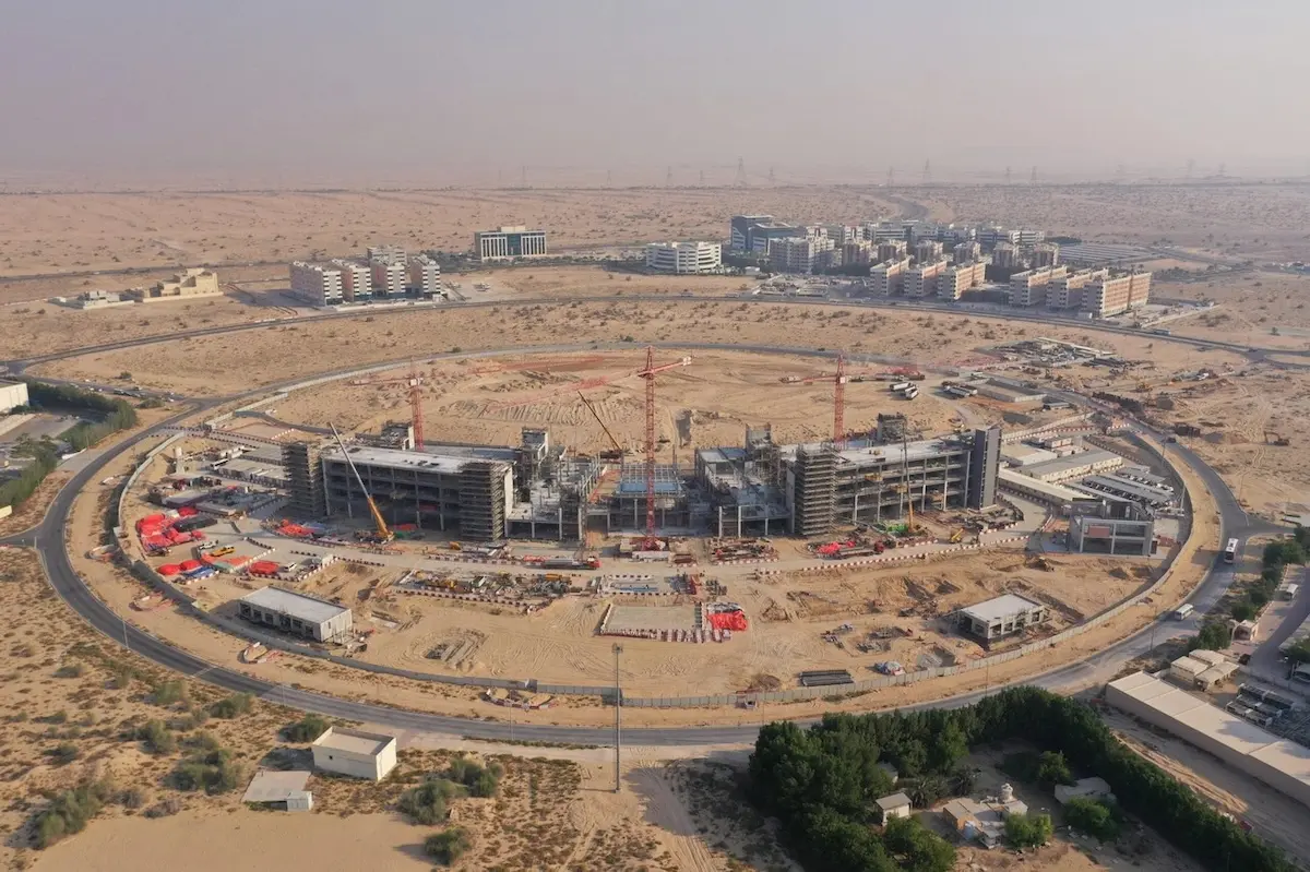
Drone surveying of UAE projects has revolutionized how we approach urban development in a country where 87.54% of the population lives in urban areas. With cities constantly expanding and evolving, traditional surveying methods simply can’t keep pace with the demanding timelines of modern construction projects.
Additionally, the extreme weather conditions in the UAE pose significant challenges for conventional surveying approaches. Drones, however, offer remarkable resistance to these harsh conditions while maintaining continuous operational capabilities. We’ve seen firsthand how Aerial Mapping Services in Dubai provide detailed site overviews, effectively mapping potential issues before construction even begins. Therefore, this technology doesn’t just save time; it transforms the entire development process.
In this article, we’ll explore how drone surveying is cutting project timelines by an impressive 60%, the specific ways it accelerates data collection, and why it has become an essential tool for urban development in the UAE.
How drone surveying speeds up data collection
Traditional surveying methods often require weeks to complete even modest projects, creating costly bottlenecks. In contrast, drone surveying in the UAE can accomplish the same tasks in mere hours or days. This dramatic acceleration happens through several key mechanisms.
First, drones capture thousands of high-resolution images in a single day, rapidly creating detailed maps and 3D models. A small drone team covers vastly more ground than traditional surveyors, capturing data points that include elevation, geo references, and color information.
Furthermore, the aerial perspective means ground operations continue uninterrupted, eliminating workflow disruptions. Aerial Mapping Services in Dubai utilize drones equipped with RTK/PPK positioning systems to achieve centimeter-level accuracy, meaning speed doesn’t compromise precision. Notably, drones excel at accessing areas too dangerous or remote for human surveyors, such as steep slopes or hazardous sites. This eliminates the safety concerns that often slow traditional surveying methods.
The efficiency extends beyond field operations. Automated data processing software quickly transforms raw drone data into actionable insights, allowing teams to begin analysis almost immediately. This continuous data workflow means project managers can identify problems early and implement changes promptly.
Consequently, drone surveying reduces overall project timelines by eliminating traditional surveying bottlenecks while maintaining or even improving data quality.
Aerial mapping and modeling: The game changer
Aerial mapping creates a digital twin of construction sites, allowing teams to interact with project data in revolutionary ways. Drone-captured imagery produces detailed 2D maps and precise 3D models that fundamentally change how projects are visualized and managed.
The technology employs two main approaches: photogrammetry and LiDAR. Photogrammetry stitches multiple aerial images together to create a comprehensive 3D representation, offering a more affordable solution than traditional methods. LiDAR uses pulsed laser light to measure distances with exceptional accuracy, particularly valuable for complex terrain mapping. These advanced mapping capabilities deliver actionable insights through various outputs, including orthomosaic maps, digital terrain models, and textured 3D models. For instance, volume calculations enable accurate measurement of stockpiles and earthworks without disrupting site operations.
The true value emerges when drone data integrates with Building Information Modeling (BIM). This combination allows teams to superimpose real-time construction progress over planned 3D models, instantly identifying discrepancies between designs and actual site conditions. One study found that aerial modeling can reduce surveying time by 60-70% compared to land-based methods.
Moreover, cloud-based platforms enable immediate data sharing across stakeholders, facilitating remote site inspections and collaborative decision-making. This accessibility ensures everyone works from the most current information, significantly reducing errors and rework.
Ensuring compliance and reducing rework
Regulatory compliance poses a constant challenge in UAE construction projects. With drones, companies now track progress and ensure adherence to strict local standards like the Estidama Pearl Building Rating System. These aerial tools capture comprehensive data that reduces costly rework by identifying issues at their earliest stages. One critical advantage of drone surveying UAE projects is proactive risk management. By providing regular aerial updates, drones help teams assess potential risks caused by weather, material shortages, or unexpected challenges. This visual documentation creates clear evidence for regulatory audits and inspections.
Accurate records established through drone data enable contractors to identify and address project errors quickly. According to recent findings, drone surveying allows site supervisors to receive up-to-date maps with precise specifications approximately one day after requesting them. This rapid turnaround prevents misalignments, poor planning, and unnoticed errors typically lead to wasted resources.
Aerial Mapping Services in Dubai further streamline collaboration through cloud-based platforms where teams can remotely access and share visual data. This transparency ensures all stakeholders remain aligned throughout the project lifecycle, thus minimizing miscommunications that often necessitate rework.
Despite being a relatively new technology, drones have already demonstrated their effectiveness in reducing construction rework by as much as 60% through
early detection of discrepancies between design plans and actual site conditions.
Conclusion
Drone surveying has undoubtedly transformed construction management across the UAE. Throughout our experience implementing this technology, we’ve witnessed firsthand how project timelines shrink by an impressive 60% when compared to traditional methods. The ability to capture thousands of high-resolution images within hours rather than weeks gives teams a significant competitive advantage in the fast-paced UAE construction market.
Additionally, the integration of drone-captured data with BIM systems creates a seamless workflow that allows us to identify and address issues before they escalate into costly problems. This proactive approach consequently reduces rework by up to 60%, saving both time and resources while ensuring projects meet the strict regulatory standards unique to the UAE.
The extreme weather conditions once posed major challenges for construction projects. However, drones now offer remarkable resilience against these harsh elements while maintaining operational continuity. Their ability to access dangerous or remote areas likewise eliminates safety concerns that typically slow traditional surveying processes.
Therefore, drone surveying represents more than just a technological upgrade – it marks a fundamental shift in how we approach urban development. The combination of speed, accuracy, and comprehensive data collection makes drones an essential tool for any construction project seeking efficiency. As we continue to embrace these aerial solutions, we expect to see even greater improvements in project outcomes, client satisfaction, and overall construction management across the UAE.
FAQs
How much time can drone surveying save on a construction project in the UAE?
Drone surveying can reduce project timelines by up to 60% compared
to traditional surveying methods. Tasks that typically take weeks can be completed in hours or days, significantly accelerating the overall construction process.
What are the main advantages of using drones for surveying in UAE construction projects?
Drones offer faster data collection, high-resolution aerial
mapping, 3D modeling capabilities, and improved safety by accessing hard-to-reach areas. They also provide real-time project monitoring and integrate well with
Building Information Modeling (BIM) systems.
How do drones help ensure compliance with UAE construction regulations?
Drones capture comprehensive data that helps track progress and ensure
adherence to local standards like the Estidama Pearl Building Rating System. They provide visual documentation for regulatory audits and enable early detection
of issues, reducing the need for costly rework.
What are some limitations of drone surveying in the UAE?
While highly effective, drone surveying may face challenges such as airspace restrictions near
sensitive locations, limited flight times, and potential weather constraints. Operators must also navigate regulatory requirements and address privacy concerns.
How accurate are drone surveys compared to traditional methods?
Drone surveys can achieve centimeter-level accuracy when equipped with RTK/PPK
positioning systems. The relative accuracy is generally 1-3 times the Ground Sampling Distance (GSD) of the original images, providing highly precise data for
construction projects.
Comments are closed