In the fast-growing construction and development environment of the United Arab Emirates, precision and speed are not optional — they are essential. 3D laser scanning and mapping UAE is taking the surveying and mapping industry to a whole new level. For companies, architects, engineers, and government bodies, being able to rely on accurate, high-resolution spatial data is critical.
In this blog, we will:
- Explain what 3D laser scanning and mapping UAE means in simple terms
- Showcase the latest developments and trends in the UAE
- Show real use cases and advantages
- Highlight how Takhteet Survey stands out as a leading provider
- Offer tips for choosing a reliable 3D scanning and mapping partner in the UAE
Let’s begin by understanding the basics.
What Is 3D Laser Scanning and Mapping?
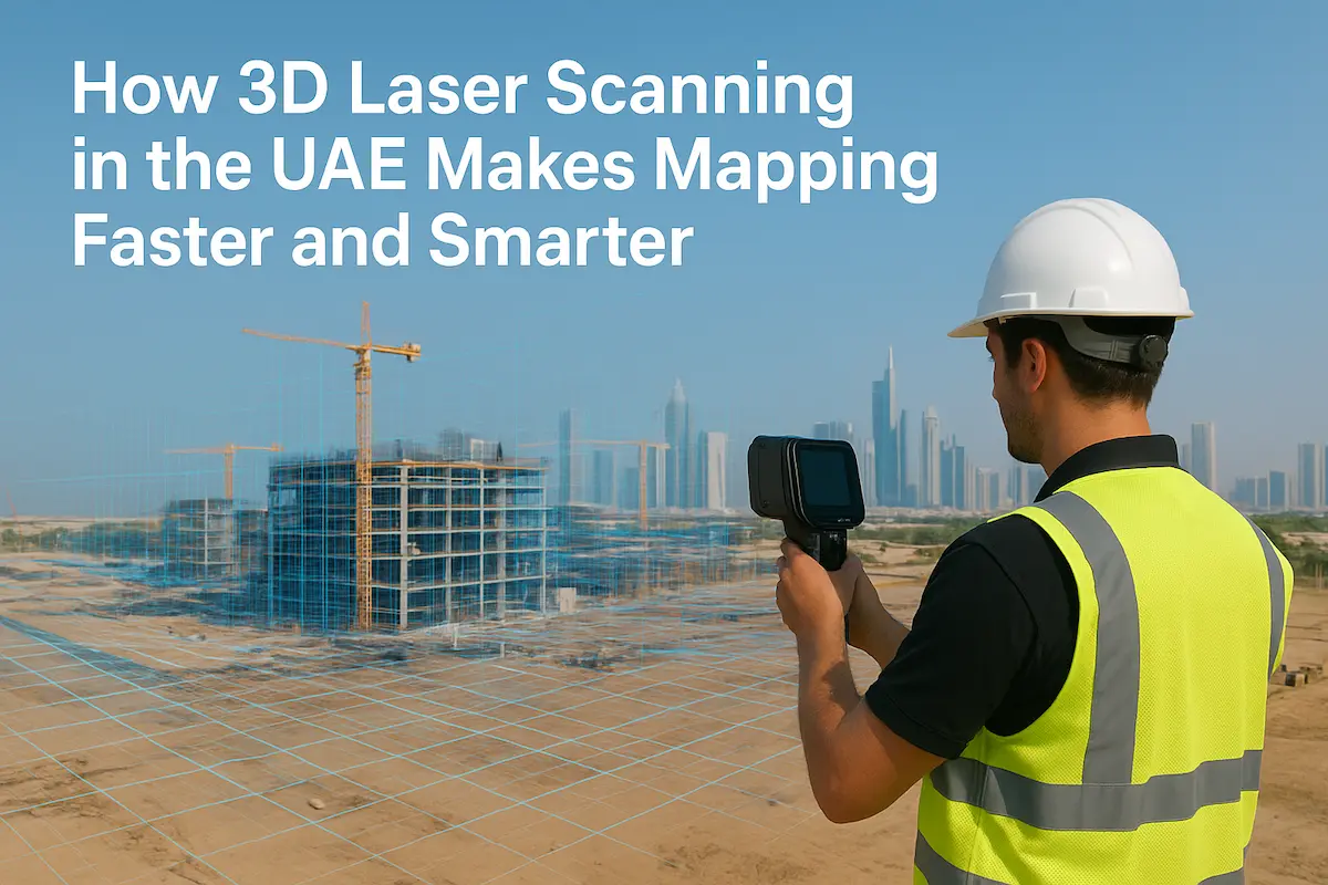
3D laser scanning and mapping UAE refers to the process of capturing physical spaces (buildings, terrain, infrastructure) using lasers to measure millions of points, creating what is called a “point cloud.” That point cloud is then processed, filtered, and converted into accurate 3D models, maps, or digital twins.
Some synonyms or related terms you might hear are:
- Laser surveying
- 3D scanning and modeling
- Point cloud mapping
- Scan-to-BIM / scan to CAD/mapping
In practice, the scanner emits laser pulses that bounce off surfaces; the time of flight (and angle) is used to compute precise distances. The data is geo-referenced, aligned, and stitched to form a complete digital map or model.
Why 3D Laser Scanning and Mapping UAE Matters Now
1. Rapid Urban Growth Demands Precision
The UAE is one of the fastest-developing nations in terms of infrastructure, real estate, and mega-projects. Projects in Dubai, Abu Dhabi, Sharjah, and beyond must meet tight schedules, regulatory approvals, and design complexities. Traditional surveying is too slow and prone to errors.
3D laser scanning and mapping UAE gives project teams the ability to capture full site data in hours or days, rather than weeks.
2. Integration with BIM & Digital Workflows
Modern construction increasingly relies on Building Information Modeling (BIM). The data from 3D laser scanning integrates smoothly into BIM, CAD, GIS, and facility management systems. This ensures that architects, structural engineers, MEP professionals, and site teams are all working from the same accurate, up-to-date model.
3. Condition Monitoring and Infrastructure Lifecycle
Once you have a precise 3D map or model, you can revisit it over time. You can monitor for deformations, structural shifts, cracks, or settlement. For roads, bridges, tunnels, or high-rise buildings, this capability adds value over the full lifecycle of the asset.
4. Safer & More Cost-Effective Surveys
In harsh or hazardous environments (industrial plants, construction zones, complex façades), manual measurement is risky. 3D laser scanning and mapping UAE allows remote capture, minimizing field risk and the need for repeat visits.
Latest Trends & Updates in the UAE
A. Drone-mounted LiDAR + Hybrid Scanning
Many UAE firms now combine terrestrial scanners with drone-mounted LiDAR or photogrammetry to cover large areas quickly. This hybrid scanning approach is especially useful for sites with mixed terrain, open areas, and vertical structures. Falcon 3D, for example, is active in drone + laser scanning across UAE projects.
B. Heritage & Cultural Site Mapping
The UAE has a growing interest in preserving its cultural heritage. 3D laser scanning and mapping UAE is being used to document historical buildings, forts, and archaeological structures. This non-invasive documentation is critical for restoration and long-term conservation.
C. Industrial Asset Digitization (Oil & Gas, Plants, Refineries)
In sectors like oil & gas, energy, and industrial plants, many companies in the UAE are leveraging 3D laser scanning and mapping the UAE for plant digitization, pipe routing, and asset lifecycle management. EIWAA Consultancy is one such firm offering scanning and modeling services for the industrial sector.
D. High Accuracy & Regulatory Compliance
Because legal, planning, and municipal bodies in the UAE demand high standards, many providers now guarantee sub-centimeter accuracy (± 1–2 cm) and align scans with UAE regulatory standards for georeferencing, survey control, and mapping delivery. The Takhteet Survey also highlights this level of precision.
E. AI / Automation in Point Cloud Processing
To reduce manual labor, some UAE firms are adopting machine learning / AI tools that can automatically classify, segment, and extract features from point clouds—walls, floors, pipes, HVAC, etc. This accelerates scan-to-BIM and modeling workflows.
Case Study
1. Landscape / Park Scanning — Abu Dhabi Corniche Park
ScanM2 completed a detailed scanning of Corniche Seaside Park in Abu Dhabi, capturing terrain and features with 2 mm accuracy. From that data, they delivered 2D maps and a BIM-ready digital model for the landscape designers.
This is a great illustration of how 3D laser scanning and mapping UAE can serve urban design, landscaping, and public projects.
2. High Rise Buildings & Façade Surveys
In Dubai, companies use laser scanning to document existing high-rise façades, structural features, and MEP elements before renovation or retrofits. Takhteet’s service pages mention scanning for as-built, condition monitoring, and façade modeling.
3. Industrial / Plant Digitization
In refineries or oil & gas facilities, scanning is done to map all piping, structural supports, machinery, and access routes. This helps in planning upgrades, detecting clashes, and asset management. EIWAA offers these services in the UAE.
4. Volume & Earthwork Calculation
For construction sites, mining, or excavation areas, 3D laser scanning and mapping UAE is used to calculate volumes of earth to be moved. This helps contractors optimize bid estimation, material movement, and cost control.
5. Heritage Documentation & Restoration
Historic forts, cultural buildings, and older architecture are scanned to create archival models. These scans assist restoration planning, virtual tours, and digital preservation.
Why Choose Takhteet Survey for 3D Laser Scanning and Mapping UAE
Here is where the Takhteet Survey can be positioned strongly. Use these points to differentiate:
1. Local Expertise + UAE Regulation Know-how
Takhteet Survey is based in the UAE and understands the regulatory, geospatial, and urban constraints of the region. Their workflows are tailored to UAE standards.
2. Broad Range of Scanning Solutions
They offer terrestrial scanners, drone/LiDAR, mobile mapping, indoor scanning, underground utility mapping, plus scan-to-BIM services
3. High Accuracy & QA/QC Rigor
They maintain strict quality assurance, registering scans, verifying georeferencing, and providing RMSE/accuracy reports.
4. Turnkey Deliverables
They deliver not just point clouds but processed models, CAD drawings, BIM models, cross-sections, and integration with GIS systems.
5. Proven Projects
Their portfolio includes large architectural, infrastructure, and commercial projects across Dubai and the UAE.
6. Innovation & Automation
Takhteet is pushing into AI-enhanced modeling, faster processing, and smart data workflows that reduce turnaround time.
All these advantages make Takhteet a strong candidate to lead in rankings for 3D laser scanning and mapping UAE.
How to Choose a Reliable 3D Laser Scanning & Mapping Partner in UAE
If someone wants to hire a provider, here are the criteria and tips.
Technology & Equipment
Check if the provider uses modern scanners (Faro, Leica, Trimble, etc.), drones with LiDAR, hybrid systems, and mobile mapping. Ensure they can adapt scanning methods to your project.
Demonstrated Accuracy
Ask for past accuracy reports or RMSE statistics, reference check points, georeferencing accuracy in cm or mm.
Experience & Portfolio
See if they have delivered in the UAE environment — desert, high humidity, large urban projects, heritage, and industrial.
Data Deliverables & Formats
They should deliver processed outputs usable in Autodesk Revit, AutoCAD, BIM, GIS, and provide documentation, cross-sections, and deliverable reports.
Regulatory & Survey Licensing
Ensure they comply with UAE mapping, survey, and cadastre regulations, permits, and alignment with municipality rules.
Turnaround & Scalability
They should be able to scale teams, handle large projects, and meet deadlines without compromising quality.
Support & Maintenance
After scan delivery, the provider should support data interpretation, updates, and re-scanning over time if needed.
Challenges & Considerations
While 3D scanning is powerful, there are some limitations or challenges one must be aware of in the UAE context:
- Reflective surfaces (glass, shiny metals) can cause noisy or missing data
- Heat, dust, and humidity can affect sensor calibration
- Dense vegetation or foliage can obstruct the line of sight
- Alignment and registration in large areas require careful ground control
- Processing large point clouds demands powerful hardware and software
- Data storage, security, and version control of 3D models can be complex
A good provider mitigates these through calibration, multiple scanning angles, overlapping scans, and rigorous post-processing.
Conclusion
The era of 3D laser scanning and mapping UAE is here, and it’s reshaping how surveying, construction, and infrastructure projects are executed across the Emirates. From accurate site captures to integration with BIM, from heritage preservation to industrial digitization, the possibilities are vast.
For developers, architects, and decision-makers, the right scanning partner can make or break your project’s success. Takhteet Survey, with its local expertise, advanced tech stack, rigorous accuracy protocols, and full suite of deliverables, is poised to lead in this domain.
If your next project in Dubai, Abu Dhabi, or elsewhere in the UAE demands precision, speed, and reliability in 3D laser scanning and mapping UAE, Takhteet Survey is ready. Contact them, discuss your scope, and see how modern surveying transforms your outcomes.
Comments are closed