
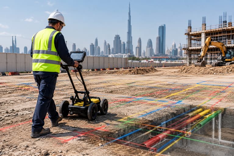
Utility mapping before excavation helps contractors understand what may be present beneath the ground before digging begins. Existing utility records, site investigation, GPR or other detection methods, survey control, utility mapping and field verification can be combined to create a clearer picture of underground conditions.
For construction projects in Dubai, Sharjah and across the UAE, this preparation can help project teams identify potential conflicts with water lines, electrical cables, telecommunications networks, drainage systems and other underground infrastructure before excavation starts.
Why Should Utilities Be Mapped Before Excavation?
Underground utilities are not always visible from the surface, and available drawings may not fully represent their current location or depth.
Excavation without sufficient information about existing utilities can create problems such as:
- Damage to underground infrastructure
- Construction delays
- Service interruptions
- Design changes
- Additional repair costs
- Safety risks
- Conflicts between existing and proposed infrastructure
Utility mapping before excavation gives contractors and project teams information they can use when planning where and how excavation should take place.
It does not eliminate every underground uncertainty, but it can significantly improve the information available before excavation begins.
What Should Contractors Check Before Excavation?
Before excavation starts, contractors should establish what information is available about the site and determine whether additional underground investigation is required.
A practical pre-excavation check should consider:
- Existing utility drawings and records
- Site reconnaissance
- Survey control and reference points
- Underground utility detection
- Utility location and depth information
- Mapping and documentation
- Conflicts with the proposed design
- Areas requiring further verification
The exact investigation required depends on the site, project scope, existing information and the level of certainty required.
Should Existing Utility Drawings Be Checked First?
Yes. Existing utility records can provide an important starting point for understanding what infrastructure may be present.
Project teams may review available information relating to:
- Water networks
- Electrical systems
- Telecommunications
- Drainage
- Gas infrastructure
- Other underground services
However, existing drawings should not automatically be treated as a precise representation of current underground conditions.
Records may be incomplete, outdated, based on different reference systems or lack sufficient information about depth.
For this reason, document review should generally be considered one part of the investigation, rather than a replacement for field verification where underground conflicts matter.
What Is Utility Mapping?
Utility mapping is the process of identifying and documenting the location of underground services in relation to the surrounding site.
Depending on the project, mapping may include information such as:
- Horizontal position
- Approximate or measured depth
- Utility type
- Direction of the service
- Access points
- Manholes or chambers
- Connections
- Other identifiable underground features
The resulting information can be represented through survey drawings, CAD data, GIS information or other project-specific deliverables.
Takhteet’s existing underground utility service covers utility mapping using technologies including GPR and other surveying methods. This article focuses specifically on what contractors should verify before excavation, rather than repeating the technology overview.
How Does GPR Help With Utility Detection?
Ground Penetrating Radar, commonly called GPR, uses electromagnetic signals to identify subsurface features and can help detect buried utilities and other underground objects.
Depending on ground conditions and the characteristics of the buried feature, GPR can assist in locating potential:
- Pipes
- Cables
- Conduits
- Voids
- Other subsurface anomalies
GPR is particularly useful when project teams need information about underground conditions without immediately excavating the entire area.
However, GPR results depend on factors such as soil conditions, target characteristics, survey methodology and site conditions. Therefore, the results should be interpreted by appropriately qualified survey professionals rather than treated as a guaranteed identification of every underground feature.
Is GPR Enough for Complete Utility Mapping?
Not necessarily.
No single detection method should automatically be assumed to identify every underground utility in every site condition.
Depending on the project, utility investigations may combine different information sources and technologies.
These can include:
- Existing utility records
- Site reconnaissance
- GPR
- Electromagnetic detection
- Surveying equipment
- Visible utility features
- Manholes and access points
- Other project-specific investigation methods
Combining information can help project teams build a more complete understanding of underground conditions.
The appropriate methodology should be determined according to the project requirements, site conditions and type of utilities being investigated.
Why Is Survey Control Important for Utility Mapping?
Detecting a buried utility is only part of the process. Its location also needs to be related accurately to the surrounding site.
Survey control provides the reference framework needed to position detected utilities within the project’s coordinate system.
This allows utility information to be connected with:
- Property boundaries
- Roads
- Buildings
- Proposed structures
- Excavation areas
- Other surveyed site features
Without a consistent spatial reference, underground information may be difficult to use effectively during design and construction.
This is why underground utility mapping in the UAE often involves both detection and surveying rather than simply identifying something beneath the ground.
What Utility Information Should Be Recorded?
The exact information required depends on the project, but a useful utility survey may document:
Utility Type
Identify the type of service where it can be reliably determined.
Location
Record the horizontal position of the detected or verified feature.
Depth
Where reliable depth information can be obtained, record the relevant depth or elevation.
Direction
Show the apparent route or alignment of the utility.
Access Features
Manholes, chambers, inspection points and other visible features can provide useful references.
Confidence or Verification Status
Where appropriate, distinguish between information obtained from existing records, detection methods and physical verification.
Clear documentation helps contractors understand what information is known and what may still require confirmation.
How Can Utility Mapping Identify Design Conflicts?
One of the main practical benefits of mapping existing utilities is the ability to compare them with proposed construction.
For example, a project may involve:
Existing underground utility → Proposed foundation → Potential conflict
or:
Existing drainage line → Proposed excavation → Potential conflict
Identifying these relationships before excavation allows engineers and contractors to review the design or construction approach.
Depending on the project, this could involve adjusting the proposed alignment, planning an appropriate excavation sequence or carrying out additional verification.
The purpose is not simply to create a utility map. It is to provide information that can support better construction decisions.
What Should Be Checked Before Excavating Near a Known Utility?
If a utility is identified near the planned excavation area, the project team should establish what information is sufficiently verified for the planned work.
Important considerations may include:
- Exact or estimated utility location
- Depth information
- Utility type
- Relationship to the excavation boundary
- Relationship to proposed structures
- Available authority or utility records
- Required additional verification
- Site safety procedures
The appropriate precautions depend on the project and the utility involved.
A survey or detection report should support, rather than replace, the project’s established excavation and safety procedures.
Why Is Utility Mapping Important for Dubai Construction Projects?
Dubai has extensive existing infrastructure beneath developed areas, including utility networks serving buildings, roads, commercial developments and other infrastructure.
This makes underground information relevant when new construction, redevelopment, roadwork or infrastructure work is planned around existing services.
For a utility mapping survey in Dubai, the objective is to establish useful spatial information about underground infrastructure before construction activities make the situation more difficult to manage.
The same principle applies across Sharjah and other UAE locations where new construction takes place alongside existing infrastructure.
What Deliverables Can Contractors Receive From a Utility Survey?
The deliverables depend on the project scope and the information requested.
They may include:
- Underground utility plans
- CAD drawings
- Survey coordinates
- Utility routes
- Depth information where established
- GPR survey information
- GIS-compatible data
- Utility schedules
- Survey reports
- Marked-up site information
Before the survey begins, contractors should confirm which deliverables are required by the project consultant, engineer or other relevant stakeholders.
This avoids completing a technically suitable survey but receiving information in a format that is difficult to use during construction.
What Are the Risks of Skipping Utility Mapping Before Excavation?
The risk depends on the site and the infrastructure present, but inadequate information can make excavation decisions more uncertain.
Potential consequences can include:
- Striking existing services
- Work stoppages
- Infrastructure damage
- Unplanned repairs
- Design changes
- Construction delays
- Additional investigation
- Safety incidents
Utility mapping cannot guarantee that every underground feature will be detected. Ground conditions, incomplete records and limitations of detection technologies can still create uncertainty.
The purpose is to reduce avoidable uncertainty before excavation, not to claim that underground conditions can always be known with absolute certainty.
A Practical Pre-Excavation Utility Checklist
Before excavation begins, contractors can use the following checklist:
☐ Review available utility records
☐ Identify known underground services
☐ Inspect visible site features
☐ Confirm the project coordinate system
☐ Establish appropriate survey control
☐ Determine whether underground detection is required
☐ Conduct GPR or other suitable detection where applicable
☐ Map detected utilities
☐ Record available location and depth information
☐ Compare existing utilities with proposed excavation
☐ Identify potential utility conflicts
☐ Verify critical areas where additional certainty is required
☐ Provide the final survey information in the required project format
This process gives the project team a structured way to review underground conditions before excavation starts.
How Can Contractors Arrange Utility Mapping in the UAE?
The first step is to define the excavation area and explain what information the project requires.
Useful information to provide a survey company includes:
- Project location
- Site boundary
- Proposed excavation area
- Existing drawings
- Available utility records
- Proposed construction drawings
- Required deliverables
- Project schedule
- Any known underground services
This allows the survey team to determine an appropriate investigation and mapping approach.
Takhteet Survey provides underground utility survey services in Dubai and across the UAE, including utility detection and mapping for construction and infrastructure projects.
Utility Mapping Before Excavation: Key Takeaway
Utility mapping before excavation helps contractors understand existing underground conditions before construction work begins. Reviewing available records, carrying out site reconnaissance, using appropriate detection methods and accurately surveying the identified utilities can provide valuable information for excavation planning.
The objective is not simply to locate underground services. It is to connect that information with the proposed construction so potential conflicts can be identified and addressed before they become costly site problems.
For projects in Dubai, Sharjah and across the UAE, Takhteet Survey provides underground utility surveying and mapping services to support safer and better-informed construction planning.
Planning excavation and need to understand what may be beneath the site? Contact Takhteet Survey to discuss your utility mapping requirements.
FAQs
What is utility mapping before excavation?
Utility mapping before excavation is the process of identifying and documenting underground services within or around a planned excavation area before construction begins.
Why should utilities be mapped before digging?
Mapping can help identify potential underground utility conflicts and provide contractors with information for excavation planning before ground disturbance begins.
Does GPR detect all underground utilities?
No detection method can guarantee identification of every underground feature in every site condition. Results can be affected by soil conditions, utility characteristics, depth and other factors.
What utilities can be identified during a utility survey?
Depending on site conditions and detection methods, surveys may help identify water lines, electrical cables, telecommunications infrastructure, drainage and other underground features.
Is an underground utility survey the same as GPR?
No. GPR is one technology that can be used during underground investigations. A utility survey can combine GPR, other detection methods, existing records and surveying to produce mapped information.
Comments are closed